
Explainer · Storms & floods
Why is a city often hotter than the countryside?
Buildings, paving, limited vegetation and waste heat change a city's energy balance. The effect varies by neighbourhood and is often especially important after sunset.
SharedMorrow Editorial · Last reviewed 2026-10-05
Follow the energy through a day
Sunlight reaches roofs, roads, trees and soil. Some is reflected, some warms the surface and some powers evaporation. A tree-shaded, moist surface can spend more energy evaporating water and less heating the surrounding air. A dry, dark paved surface often follows a different balance.
Concrete and other materials can store heat and release it later. Buildings also change shade and airflow. At night, a dense built-up area may cool more slowly than its surroundings. Transport, industry and cooling equipment add waste heat. No single material or activity explains every city, but the combined effect can produce an urban heat island.
Three temperatures, three different questions
| Measurement | What it describes |
|---|---|
| Surface temperature | How hot a roof, road or patch of ground is; often observed by thermal remote sensing |
| Air temperature | Conditions in the air at a stated height and exposure |
| Indoor temperature | Conditions inside a building, affected by insulation, ventilation, occupancy and cooling |
A satellite image of a very hot road does not establish that the air temperature is equally high. Nor does a comfortable shaded weather station prove that every flat is safe. Measurement method and location belong in any comparison.
Why the night matters
- Surfaces absorb and store energy during the day.
- Built structures and limited sky exposure can slow heat loss after sunset.
- Warm indoor spaces may not cool sufficiently before the next hot day.
- Repeated hot days and nights can reduce opportunities for people and buildings to recover.
This is one reason daily maximum temperature alone does not capture the experience of a heatwave. Housing, work schedules, access to cooling and health conditions affect how much heat a person actually experiences. The same forecast can mean very different things for a shaded ground-floor home and an uncooled upper-floor room.
What a city photograph can show
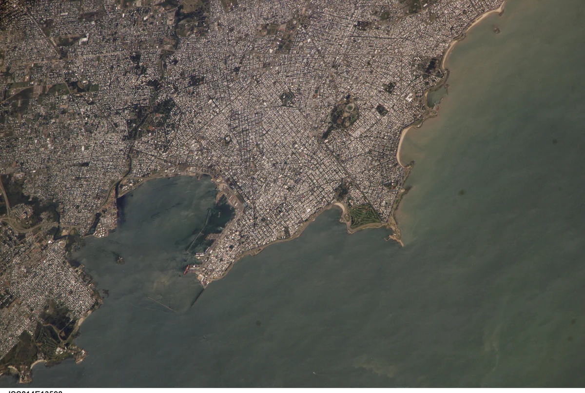
The astronaut photograph of Montevideo shows a dense built landscape beside water. It is ordinary visible-light photography, not a thermal map. It helps locate surfaces and urban form, but cannot establish which neighbourhood was hottest at the time.
To evaluate a cooling project, cities need measurements that match the claim. A cooler roof surface is useful evidence about that roof. Demonstrating lower indoor exposure or a neighbourhood-wide air-temperature benefit requires additional observations. Before-and-after comparisons must also account for weather differences.
Cooling choices have trade-offs
Trees can provide shade and support evaporation, but species, water availability, maintenance and placement matter. Reflective roofs can reduce absorbed sunlight; the effect depends on the building and climate. Ventilation, insulation and shading need to work together. Opening windows is not a universal answer when outdoor air is hotter or polluted.
Urban design does not replace climate mitigation. A hotter global background and local heat-island effects can occur together. Nor does cooling one showcase street ensure equitable protection. People without reliable housing, power or access to cool places may remain exposed.
Common questions
Are cities always hotter at every hour? No. The pattern depends on season, time, weather, land cover and the comparison site. Some dry-region cities can be cooler than nearby bare land during part of the day.
Is a heat island the same as a heatwave? No. A heatwave is an episode of unusually hot conditions; an urban heat island is a spatial contrast. They can overlap.
What should I check during hot weather? Local heat alerts, overnight conditions and the places where you actually spend time. A citywide average cannot describe every room or street.