
Explainer · Wildfire & environment
How can wildfire smoke travel thousands of kilometres?
Fine particles and gases can be lifted high above a fire and carried by winds far beyond the burned area. What people breathe at ground level depends on the plume's height, mixing and weather along the way.
SharedMorrow Editorial · Last reviewed 2026-10-05
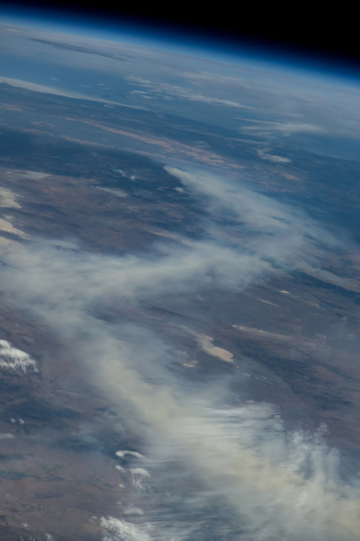
The fire makes a mixture
Smoke contains particles and gases produced by burning vegetation and other materials. Its composition varies with fuel and combustion conditions. Fine particulate matter, often discussed as PM2.5, is a major health concern because these small particles can be inhaled deeply. Smoke is not just the visible dark material close to flames.
Heat makes air rise above the fire. Intense convection can lift a plume into stronger winds aloft, and some fires produce towering fire-driven clouds. Once airborne, smoke is transported, diluted, chemically altered and removed by processes such as precipitation. There is no fixed distance at which it simply becomes harmless.
A plume has a vertical dimension
- Fire and convection lift smoke above the source.
- Winds at the plume's altitude carry it, sometimes in a different direction from surface winds.
- Weather systems move, stretch and mix the plume over time.
- Some smoke remains aloft; some mixes down to the air people breathe.
This explains why a dramatic satellite plume does not map directly onto ground-level exposure. Conversely, a hazy or smoky surface layer may be important even when a photograph from above looks less striking. The observations answer different questions.
What each map can tell you
| Information | Useful for — and limited by |
|---|---|
| Satellite smoke image | Locating the plume; does not directly measure every person's breathing-zone concentration |
| Ground PM2.5 monitor | Measuring local particle levels; coverage and instrument quality vary |
| Air-quality index | Communicating concentration-related concern under that system's definitions |
| Smoke forecast | Anticipating transport; sensitive to fire emissions, winds and mixing assumptions |
Different countries use different index scales and categories. Compare the underlying pollutant, averaging period and local advice rather than assuming that the same colour or number means exactly the same thing everywhere.
Why distant communities are affected
The Canadian smoke photographed from the International Space Station in August 2024 shows transport on a continental scale. It is a historical image, not today's air-quality map. Distance from the fire reduces some direct hazards, but it does not guarantee clean air downwind.
Air pollution can also have several sources at once. A local traffic contribution, industrial emissions and transported smoke may overlap. Attribution of the measured concentration requires more evidence than a smoky smell or a regional news story.
What can change over a day
A wind shift can move the plume away. Daytime mixing can bring smoke from aloft toward the surface, while a stable layer may trap pollution near the ground. Rain can remove some particles, but a passing shower does not necessarily clear a whole regional smoke episode.
For daily choices, current local air-quality observations and public-health advice are more useful than the distance to the nearest fire. Indoor conditions also depend on outdoor infiltration, filtration and indoor particle sources. “Inside” is not a single exposure level, especially in buildings without effective filtration or during power failures.
Common questions
If I cannot smell smoke, is the air safe? Smell is not a reliable measurement of fine-particle concentration. Check local observations and guidance.
Does an orange sky always mean the worst pollution is at the surface? No. Light can pass through smoke high above you; surface measurements are still needed.
Can a smoke forecast tell me the exact concentration outside my door? No. It provides useful guidance, but local conditions and model uncertainty remain. People with health concerns should use the relevant public-health advice rather than treating a forecast as an individual medical assessment.