
Before a crisis
Identify local fire, air-quality and evacuation channels, reduce feasible fuel risks, and include people who may need extra help.
Topic
Explore wildfire, smoke, environmental effects and community recovery with explicit place, date and uncertainty. Satellite images offer observations, not ground verification or personal safety instructions.
Identify local fire, air-quality and evacuation channels, reduce feasible fuel risks, and include people who may need extra help.
Follow local instructions; do not expose precise people or routes, and state the observation and image times.
Track housing, health, land, culture, insurance and livelihoods; a contained fire does not mean recovery is complete.
Compelling fire imagery is only one part of recovery, which also includes housing, air, culture, land and livelihoods. Heat anomalies, burn perimeter and smoke may come from different sensors and times.
Common errors are reading a bright satellite pixel as exact building loss or assuming containment ends risk. Clouds, resolution, timing and ground verification limit interpretation.
Record sensor, time, scale and legend, then compare with ground-agency updates. Label observation, inference and unknowns separately, and never publish a person’s precise location.
Scenario: a satellite product shows a new hotspot while a ground agency reports containment. Compare sensor time, resolution, cloud cover and the latest ground update; keep active fire, perimeter and smoke extent distinct. A single image cannot establish damage to a specific home or complete recovery.
Vegetation, climate, construction, evacuation systems and land management vary. FAQ: does a before-and-after image prove recovery? No; it shows visible change, not the full state of services and residents.
Q: Does containment mean the crisis is over? A: No; air, housing, water, land, livelihoods and psychosocial recovery may continue. Q: What can before-and-after imagery prove? A: Visible change, not the full recovery of residents and services.
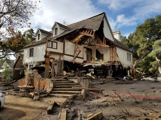 ExplainerWhy can a burned hillside produce a debris flow?A wildfire can leave a slope less able to absorb and slow rainfall. Intense runoff can then gather soil, rocks and woody material into a fast-moving flow, sometimes before much rain has fallen nearby.
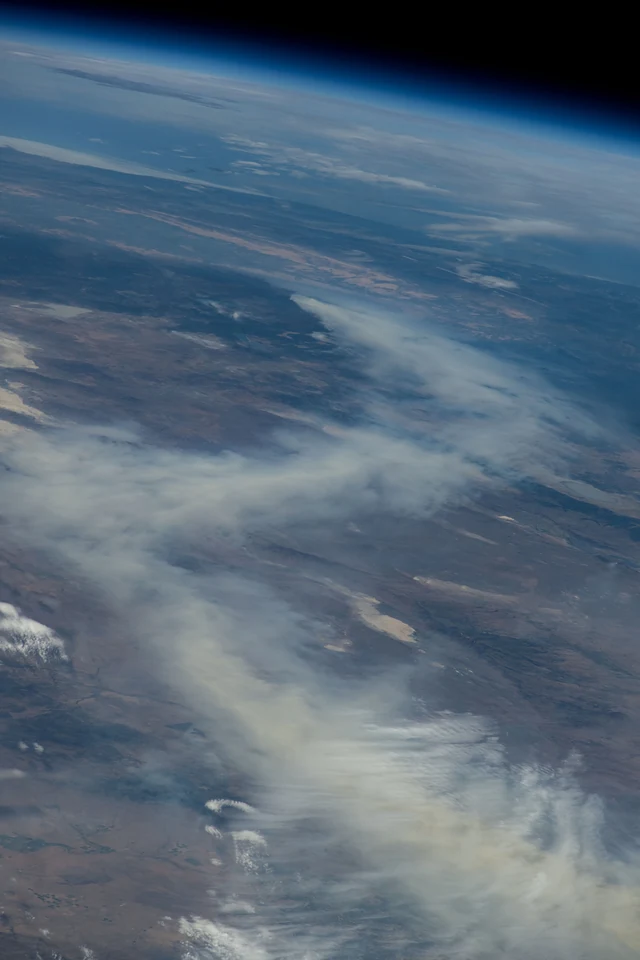 ExplainerHow can wildfire smoke travel thousands of kilometres?Fine particles and gases can be lifted high above a fire and carried by winds far beyond the burned area. What people breathe at ground level depends on the plume's height, mixing and weather along the way.
Official SharedMorrow editorial account for curated resources, topic maintenance, and community discussion starters.